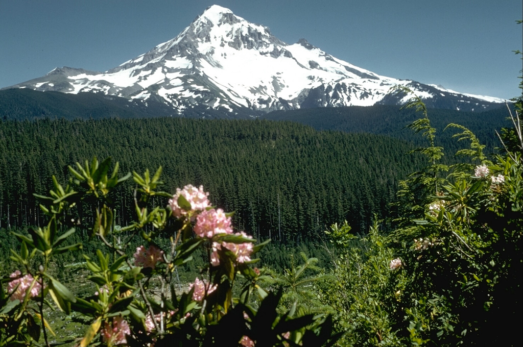
Mount Hood, Oregon's highest peak, forms a prominent backdrop to the city of Portland. The eroded summit area consists of several andesitic or dacitic lava domes. Major Pleistocene edifice collapse produced a debris avalanche and lahar that traveled north down the Hood River valley and crossed the Columbia River. The glacially eroded volcano has had at least three major eruptive periods during the past 15,000 years. The last two occurred within the past 1,800 years from the central vent high on the SW flank and produced deposits that were distributed primarily to the south and west along the Sandy and Zigzag rivers. The last major eruptive period took place beginning in 1781 CE, when growth of the Crater Rock lava dome was accompanied by pyroclastic flows and lahars down the White and Sandy rivers. The Sandy River lahar deposits extended to the west as far as the Columbia River and were observed by members of the 1804-1805 Lewis and Clark expedition shortly after their emplacement. Minor 19th-century eruptions were witnessed from Portland.
Hood Volcano — United States
StratovolcanoType
1866Last eruption
3426 mElevation
United StatesCountry
Advertisement
Recent earthquakes nearby
- …
Biggest historic earthquakes in the area
- …
Advertisement