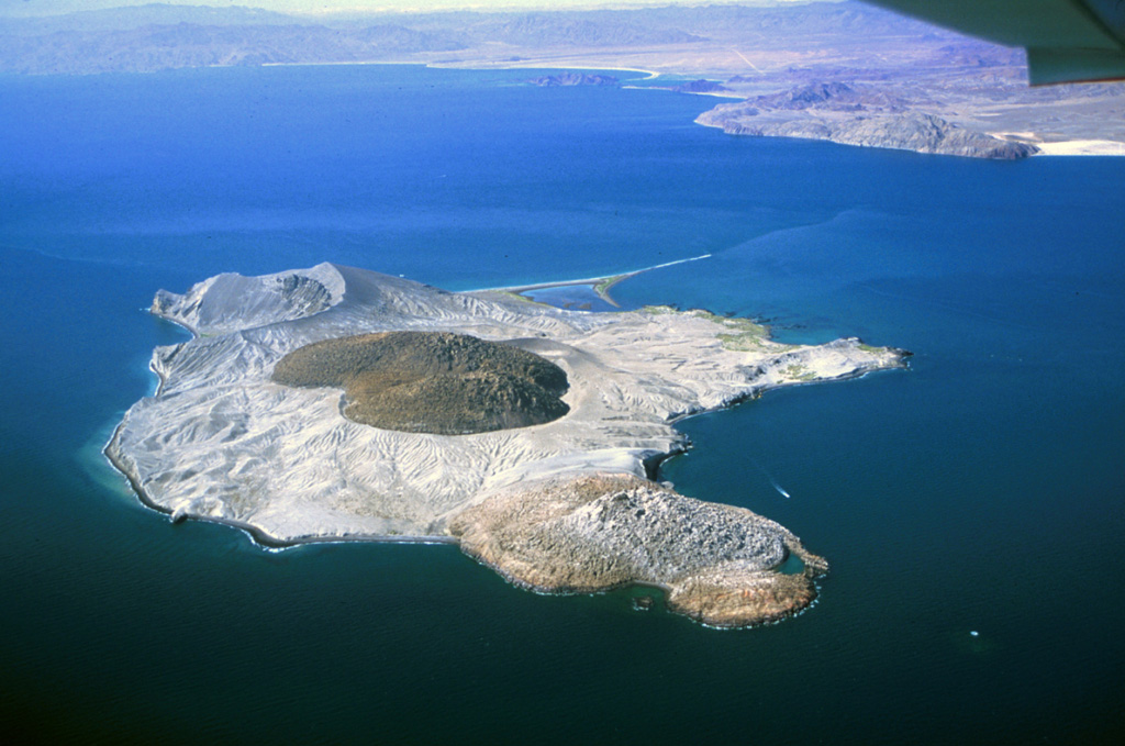
Isla San Luis is the largest of the seven Encantada islands at the NW end of the Guaymas lineament in the northern part of the Gulf of California. The 4.5 km2 island (also known as La Encantada Mayor, or Salvatierra) is located 3 km off the eastern shore of Baja California north of Punta Bufeo, and has an irregular shoreline with a narrow peninsula forming its SW tip. Initial basaltic andesite and andesitic submarine eruptions producing palagonite tuffs were followed by effusion of subaerial dacitic lava flows and the formation of dacitic tuff rings. The latest eruptions formed two rhyolitic obsidian domes, the younger in a tuff cone at the center of the island and at the older at the NW tip of the island. In their detailed study of the island, Paz Moreno and Demant (1999) did not specifically suggest Holocene activity, but noted that the "well-preserved morphology of the volcanic structures clearly support a late Quaternary age for all the eruptive activity" and that the northern lava dome may have been emplaced during the 110-130 ka interglacial period. Hausback aet al. (2003) 14C dated marine mollusk shells associated with three eruptions in the last 5,000 years.
San Luis, Isla Volcano — Mexico
Advertisement
Recent earthquakes nearby
- …
Biggest historic earthquakes in the area
- …
Advertisement